High-quality drone imaging tailored for Southwest Florida, capturing stunning aerial views that enhance real estate listings, assist in construction monitoring, and provide breathtaking perspectives of the beautiful landscapes and coastlines unique to the region.
Real Estate

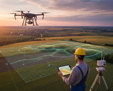

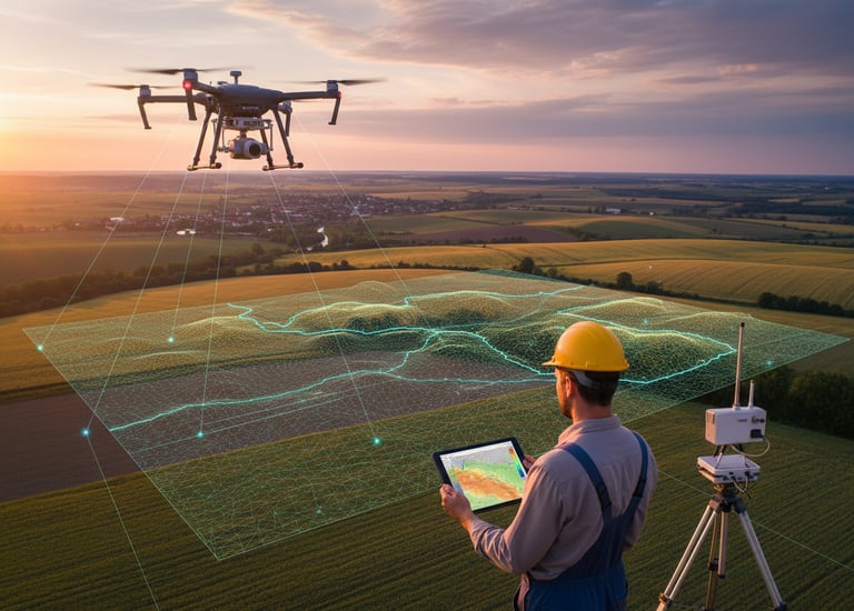
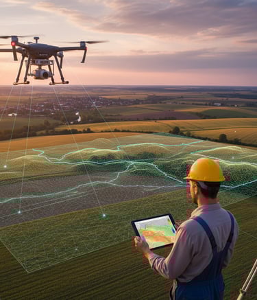
Drone Mapping
Drone mapping is ideal for construction, real estate, agriculture, inspections, and land development. It delivers faster results, improved accuracy, and eliminates the need for risky manual measurements.
This process involves a drone equipped with various sensors, such as cameras and thermal imagers, to collect high-resolution data for analysis, including identifying issues like cracks, corrosion, and heat loss
Thermal Imaging & Inspections
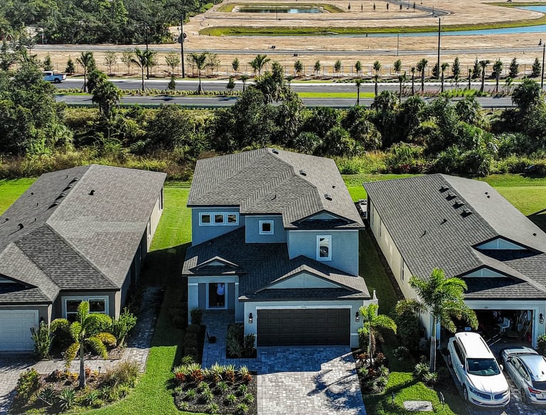
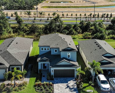
Showcase SWFL properties from a unique perspective. Specializing in high-quality real estate drone photography and video, highlighting pools, landscapes, and location context.
Services
Elevate your projects with our full suite of professional drone UAV services, powered by the advanced Autel Robotics EVO Lite+ 640T Enterprise with thermal imaging capabilities. We provide cutting-edge aerial data and imagery for real estate professionals, commercial developers, and industrial clients in Cape Coral and throughout Southwest Florida.
We are:
FAA-Licensed, Fully Insured, and Committed to Quality.
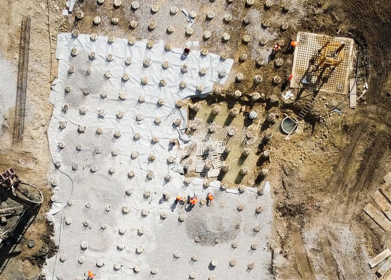
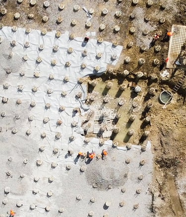
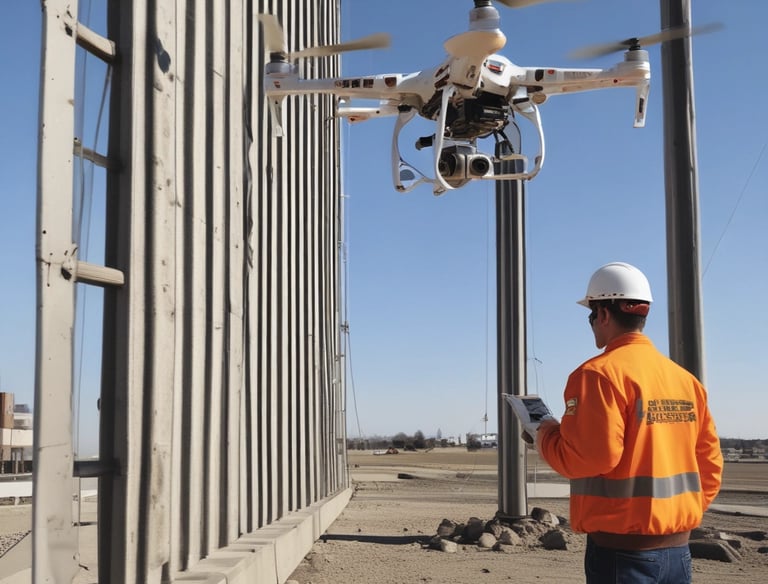
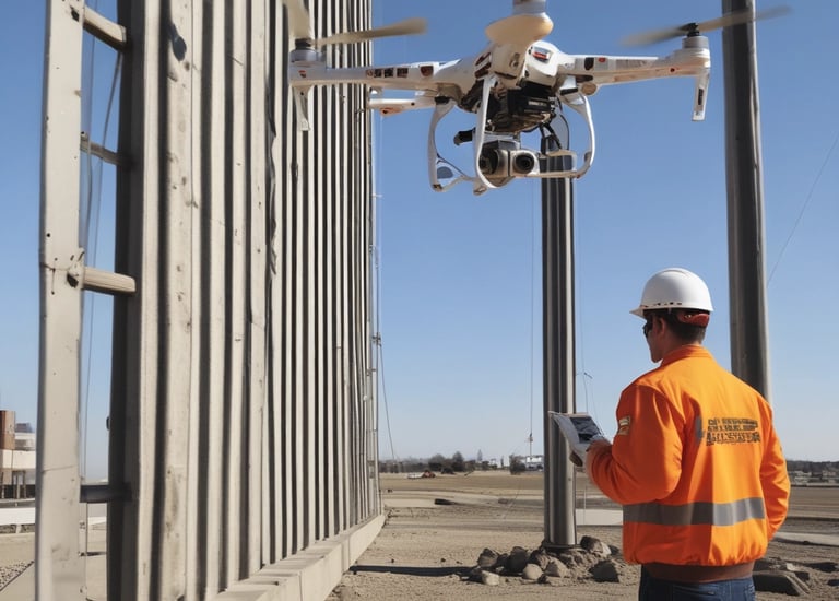
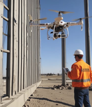
Drone UAV Mapping
Achieve superior site planning and project oversight with our professional drone mapping services.
We generate highly accurate 2D orthomosaic maps and 3D models for construction sites, land development, and environmental assessments. Visualize and measure complex terrain with precision for effective decision-making.
See your project with unmatched clarity. Drone Mapping transforms aerial data into powerful, high-precision maps that help you plan smarter, build faster, and avoid costly errors. Our enterprise-grade drones capture centimeter-level detail, giving you insights traditional surveying simply can’t match.
Perfect for construction teams, real estate professionals, property managers, and agricultural operations, drone mapping delivers:
Faster project assessments
Safer inspections with zero climbing or risk
Precise measurements and actionable data
Professional 2D and 3D mapping for reporting or client presentations
With fewer labor hours, reduced rework, earlier issue detection, and better documentation, drone mapping offers outstanding ROI. Clients save thousands by preventing errors, expediting timelines, and optimizing decision-making from day one.
One flight can pay for itself.
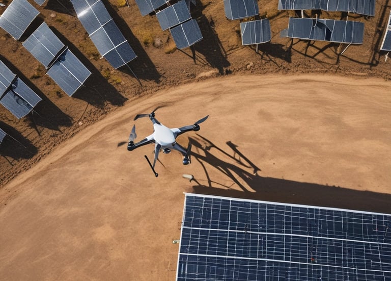
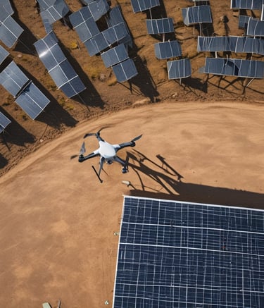
Drone UAV Inspections
Ensure safety, efficiency, and predictive maintenance with our advanced inspection capabilities.
The Autel Robotics EVO Lite 640T Enterprise allows us to conduct detailed visual inspections of critical infrastructure, including:
Solar Panel Assessments: Identify overheating cells or panel defects instantly.
Roofing & Facades: Detect insulation issues, moisture intrusion, and structural wear without risk.
Industrial Sites: Monitor pipelines, power lines, and machinery for anomalies and potential failures.
We deliver actionable insights and comprehensive reports, allowing you to pinpoint problems quickly and prevent costly downtime.
Contact us today for a free consultation and customized quote!

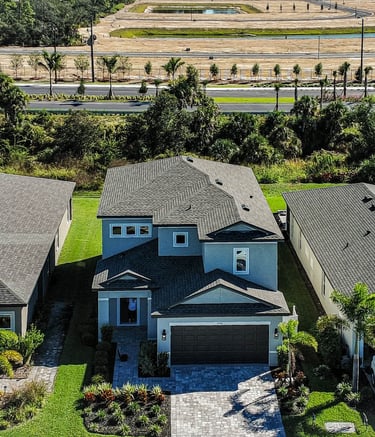
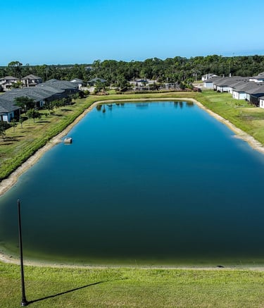
Drone UAV Real Estate Photography
Transform property listings and attract serious buyers with stunning aerial visuals. We capture cinematic 4K video tours and high-resolution photographs that effectively highlight property layouts, unique features, landscapes, and proximity to amenities. Our dynamic media packages ensure your listings stand out in a competitive market.
Benefits for Real Estate:
High-impact marketing visuals
Detailed property and lot layout maps
Better land-use planning
Clear documentation for surveys and appraisals
ROI:
Properties sell faster, attract higher-value buyers, and improve negotiation power. Drone maps eliminate guesswork, reduce due-diligence time, and enhance the overall buying experience.

FAQs
Are you licensed?
Yes, we are fully FAA Part 107 remote pilot licensed and insured.
What services offered?
We provide video, photos, orthomosaic and point cloud maps, thermal imaging for real estate, construction, mapping, and inspections.
How does thermal imaging help?
Thermal imaging reveals heat patterns to detect issues like leaks, electrical faults, or insulation problems quickly and accurately.
Where do you operate?
We serve the Southwest Florida area with reliable drone imaging solutions.
How fast is delivery?
Typically, we deliver your images and data within 48 hours after the flight.
Can you customize data for my project?
Absolutely, we tailor our imaging and reporting to fit your specific project needs and goals.
Contact:
Email:
Phone:
(239) 899-0648
© 2026. All rights reserved. Website by MindBotics